Original Case Study Title: Pierce County, Washington- A Comprehensive Approach
Original Document: NAI How-to Guide for Hazard Identification and Floodplain Mapping ASFPM, 2017. Pages 101-105.
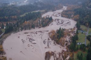
Summary: Large river flooding occurs mostly from November through February, when rains and snow melt overload channels. With larger rivers and generally undeveloped upper watersheds, the County knew that it needed to concentrate its mapping program in the floodplains. They followed 8 distinct steps to do so.
For more information contact Dennis Dixon at ddixon@co.pierce.wa.us